


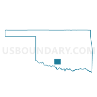
Voting District 62, Stephens County, Oklahoma
About
Outline

Summary
| Unique Area Identifier | 655208 |
| Name | Voting District 62 |
| County | Stephens County |
| State | Oklahoma |
| Area (square miles) | 62.82 |
| Land Area (square miles) | 56.35 |
| Water Area (square miles) | 6.47 |
| % of Land Area | 89.70 |
| % of Water Area | 10.30 |
| Latitude of the Internal Point | 34.34081440 |
| Longtitude of the Internal Point | -98.06036220 |
Maps


Graphs
Select a template below for downloading or customizing gragh for Voting District 62, Stephens County, Oklahoma


Neighbors
Neighoring Voting District (by Name) Neighboring Voting District on the Map
- Voting District 1, Cotton County, OK
- Voting District 3, Jefferson County, OK
- Voting District 4, Jefferson County, OK
- Voting District 41, Stephens County, OK
- Voting District 42, Stephens County, OK
- Voting District 5, Cotton County, OK
- Voting District 61, Stephens County, OK
- Voting District 63, Stephens County, OK
Top 10 Neighboring County Subdivision (by Population) Neighboring County Subdivision on the Map
- Comanche CCD, Stephens County, OK (5,672)
- Walters CCD, Cotton County, OK (3,794)
- Waurika CCD, Jefferson County, OK (2,835)
- Temple CCD, Cotton County, OK (1,252)
Top 10 Neighboring Place (by Population) Neighboring Place on the Map
Top 10 Neighboring Elementary School District (by Population) Neighboring Elementary School District on the Map
Top 10 Neighboring Unified School District (by Population) Neighboring Unified School District on the Map
- Comanche Public Schools, OK (5,526)
- Walters Public Schools, OK (3,537)
- Waurika Public Schools, OK (2,755)
- Empire Public Schools, OK (2,184)
- Temple Public Schools, OK (1,333)
Top 10 Neighboring State Legislative District Lower Chamber (by Population) Neighboring State Legislative District Lower Chamber on the Map
Top 10 Neighboring State Legislative District Upper Chamber (by Population) Neighboring State Legislative District Upper Chamber on the Map
Top 10 Neighboring 111th Congressional District (by Population) Neighboring 111th Congressional District on the Map
Top 10 Neighboring Census Tract (by Population) Neighboring Census Tract on the Map
- Census Tract 11, Stephens County, OK (5,672)
- Census Tract 8711, Cotton County, OK (3,794)
- Census Tract 3718, Jefferson County, OK (2,835)
- Census Tract 8712, Cotton County, OK (2,399)
Top 10 Neighboring 5-Digit ZIP Code Tabulation Area (by Population) Neighboring 5-Digit ZIP Code Tabulation Area on the Map
- 73529, OK (5,344)
- 73572, OK (3,699)
- 73573, OK (2,551)
- 73568, OK (1,182)
- 73548, OK (519)
- 73520, OK (149)